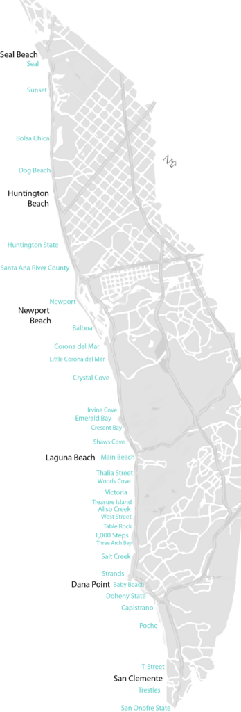
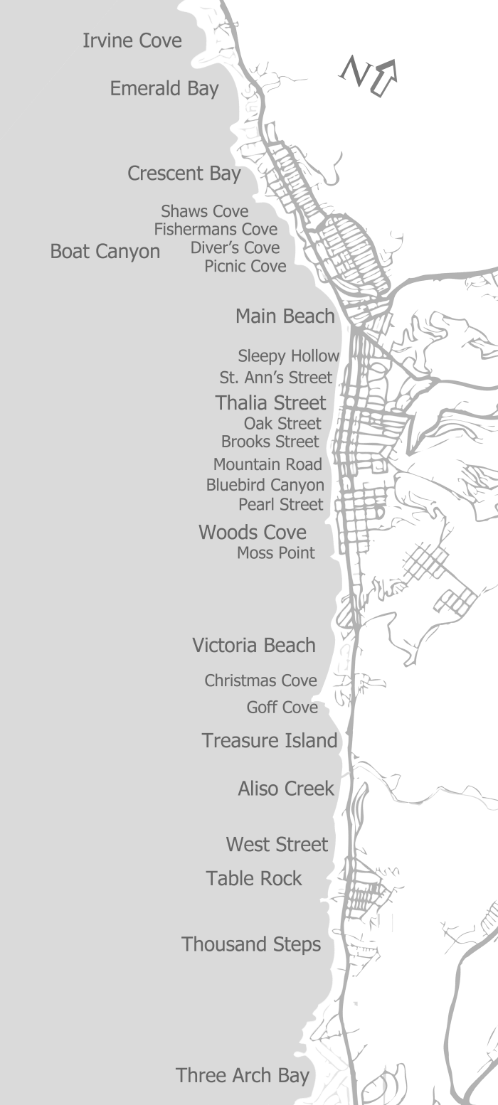
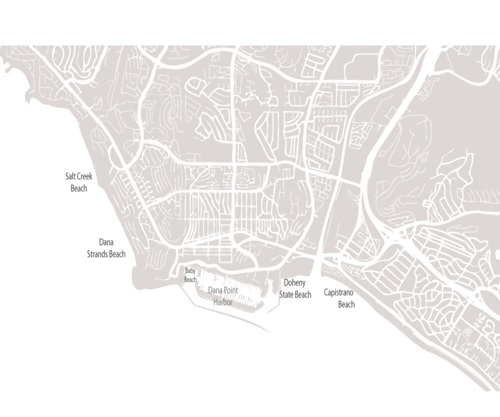
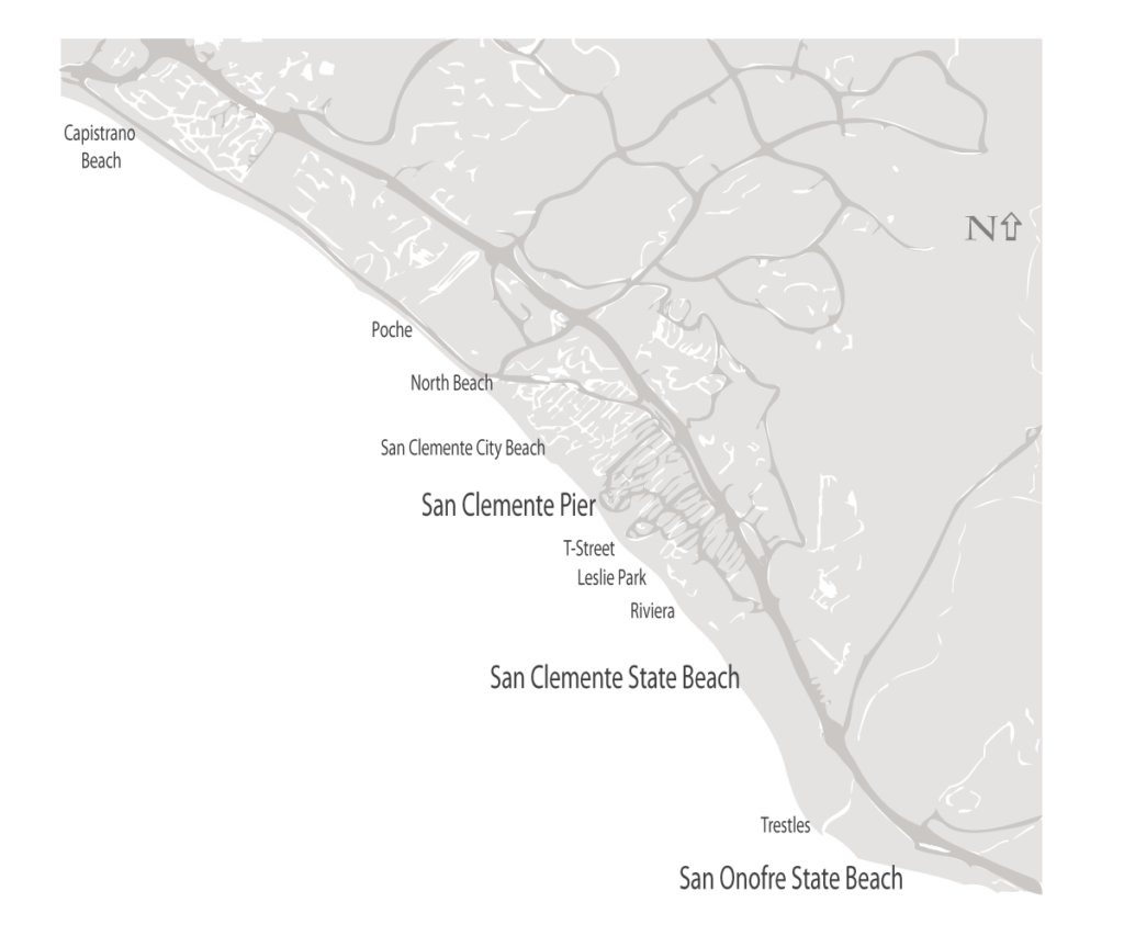
The coastline of Orange County in Southern California is home to almost 50 beaches in six beach cities. The Orange County Beaches Map below highlights the location of those beaches. At the bottom of this page are maps of each beach town for a closer look at those towns and its beaches.
Orange County is home to six beach towns. Each town has its own character and its beaches are no different. From the long stretch of sandy beaches known for world famous surfing in Huntington Beach to the hidden and picturesque beaches in Laguna Beach, each beach and town is a sight and experience to remember. From north starting with Seal Beach to the southern most Orange County town of San Clemente, here are quick maps of the beach locations to guide you on your journey.